
June 17, 2026 10:13 pm

Menu


Active Weather Week Ahead: Severe Storms, Heavy Rain, and Flooding Possible
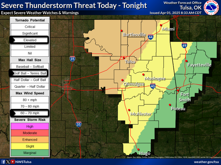
A volatile weather pattern is setting up across the region this week, bringing multiple rounds of thunderstorms and the potential for severe weather. Forecasters are warning residents to stay alert as the combination of heavy rainfall, high winds, and severe storms could lead to hazardous conditions.
Heavy Rain and Flooding Risk
Rainfall totals between 2 to 7 inches are expected across the area, with localized amounts potentially exceeding that. The heaviest rain is forecast from mid to late week, which could result in flooding, particularly in southeast Oklahoma and west central Arkansas.
High Winds Expected Tuesday
A Wind Advisory is in effect for parts of eastern Oklahoma on Tuesday and Tuesday night, with south winds of 20 to 30 mph and gusts reaching up to 45 mph. These winds could cause difficulty for high-profile vehicles and may result in scattered power outages.
Severe Weather Threat Tonight into Wednesday
The threat of severe weather increases this evening through tonight, with the potential for:
Very large hail
Locally damaging winds
Tornadoes, including the possibility of strong tornadoes this evening
An isolated severe storm could move into eastern Oklahoma by this evening, followed by more widespread thunderstorms late tonight into Wednesday. The overnight storms will also carry a risk of severe weather, which is expected to continue through the day Wednesday.
Continued Threat Through Wednesday
As the storm system lingers, Wednesday remains a day of concern. All types of severe weather are on the table, including hail, damaging winds, flash flooding, and tornadoes.
Stay Weather Aware
Residents are urged to stay informed by monitoring local forecasts and weather alerts. Have a severe weather plan in place, and ensure your mobile devices are charged and set to receive emergency notifications.


Copyright © 2025 TheHenryettan.com – All rights reserved.